


Certified Farms

Babcock Ranch
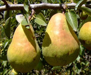
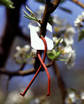
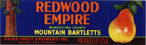
The Hildreth Farms—Babcock Ranch (30 acres), Home Ranch (80 acres), Ledford Ranch (50 acres), Robinson Ranch (38 acres), and Scott-Williams Ranch (68 acres)—total 266 acres in the Ukiah Valley with both pear orchards and winegrapes. Each farm has a range of soil and water conservation practices as well as low chemical use. Mike Hildreth uses an IPM program for pears using pheromone disrupter lures against coddling moths in his orchards, reducing the need for insecticides. Robinson Creek borders one Hildreth Farm site and is managed by planting native riparian species.
Beck 3 Vineyard
Burke Hill Ranch
Butler Ranch
Chalfant Ranch & Ledford Ranch
Cononiah Vineyard
This 100-acre site borders the Mill Creek alluvial fan. Ed Berry uses soil conservation methods, such as cover crops and road winterization practices, to prevent the delivery of fine sediment to Mill Creek.
Dark Horse Vineyard
This 165-acre site is an organic and biodynamic vineyard interspersed with oak woodland. Hedgerows of flowers support beneficial insects.
Downey Vineyards
This 32-acre vineyard borders Howell Creek and uses cover crops to protect the soil from erosion.
El Roble Ranch
Garzini Ranch

Haiku Vineyard
This 160-acre site borders Morrison Creek and the Russian River. Organic cultivation practices are used and a native plant revegetation project along Morrison Creek was completed in 2002. In 2007, Haiku Ranch received an FFF award recognizing Outstanding Efforts in Stream Habitat Improvement and Restoration.
Hillside Vineyards
This site, planted with grapes in the 1970s, has been farmed organically since 2000.
Home Ranch
The Hildreth Farms—Babcock Ranch (30 acres), Home Ranch (80 acres), Ledford Ranch (50 acres), Robinson Ranch (38 acres), and Scott-Williams Ranch (68 acres)—total 266 acres in the Ukiah Valley with both pear orchards and winegrapes. Each farm has a range of soil and water conservation practices as well as low chemical use. Mike Hildreth uses an IPM program for pears using pheromone disrupter lures against coddling moths in his orchards, reducing the need for insecticides. Robinson Creek borders one Hildreth Farm site and is managed by planting native riparian species.

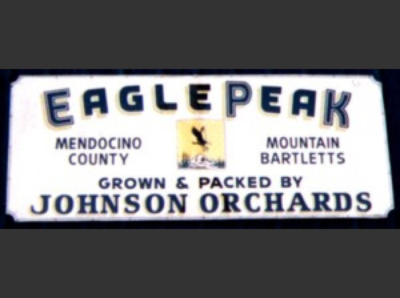
Johnson Orchard and Vineyards
Peter Johnson manages his family’s pear orchards with low chemical inputs and the IPM program for pears using the pheromone disruptor system. Doolin Creek and the Russian River border the orchards and vineyards. Natural measures are used to address bank erosion on the river.

King Farms
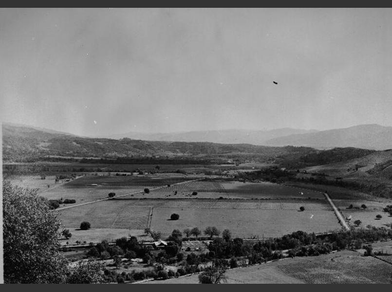
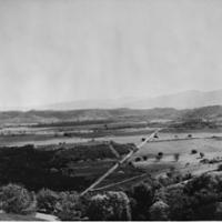
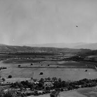
The King Farm, located on the eastern side of Ukiah Valley, stretches from the Russian River to the ridgetop covering 1,500 acres. Owned by the King family, which has farmed since 1919, the property has 45 acres of vineyards. Cover crops are used to protect soil and water quality. The remainder of the property is wildlife habitat and open space, with minimal grazing. The King family is well-known for its environmental land stewardship and enhancement of wildlife habitat. The late Malcolm King envisioned restoring the riparian corridor along the Russian River on his property and as part of the Fish Friendly Farming program, his wife Janet King and daughter and son-in-law Becky and Steven Koenig completed this vision with the largest single restoration project in the Russian River area. An 8-acre riparian restoration project was completed along the Russian River. The King family's long-term excellent land management, care for wildlife and the Russian River has earned them a distinction as the 2003 Fish Friendly Farming Outstanding Land Steward of the Year in Mendocino County.

La Ribera Vineyards
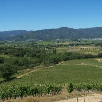
This 150-acre vineyard along the Russian River is part of a 230-acre property. Al White, vineyard manager, has used no-till practices to conserve soil since 1998. Morrison Creek, along the northern boundary of the site, was revegetated through a project as part of the Fish Friendly Farming program. The river corridor is managed to enhance wildlife habitat. In 2007, La Ribera Vineyards was given an award by Trout Unlimited and California Trout recognizing outstanding efforts in stream habitat improvement and restoration.
Larramendy Vineyards
Larramendy Vineyard change text This 27-acre family farm includes 20 acres of vineyard managed with cover crops to protect soil and water quality.
Ledford Ranch
The Hildreth Farms—Babcock Ranch (30 acres), Home Ranch (80 acres), Ledford Ranch (50 acres), Robinson Ranch (38 acres), and Scott-Williams Ranch (68 acres)—total 266 acres in the Ukiah Valley with both pear orchards and winegrapes. Each farm has a range of soil and water conservation practices as well as low chemical use. Mike Hildreth uses an IPM program for pears using pheromone disrupter lures against coddling moths in his orchards, reducing the need for insecticides. Robinson Creek borders one Hildreth Farm site and is managed by planting native riparian species.

Main Ranch
The Ruddick Ranch of 327 acres encompasses both pear orchards and vineyards stretching along Howell Creek and the Russian River. Chris Ruddick manages the pears using an IPM program for pears with pheromone disrupter system which affects the mating habits of the coddling moth. Insect monitoring then allows the farmer to determine locations where the insects are a problem and treat only those areas of the orchards, resulting in a reduced use of insecticides. Chris plants willows along the river bank to increase stability in this area of the Russian River, where there are high levels of bank erosion.
Mendocino 101 Vineyard
Mendocino Hill Vineyards
Norgard Farms
Parducci Home Ranch
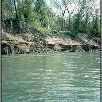
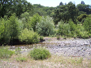
Robinson Creek
This 59-acre site on Robinson Creek is managed with soil and water conservation. Mike Milovina cares for the creek along his property by removing invasive non-native plant species like blue periwinkle and giant reed (Arundo donax). See also Milovina Vineyards—Largo Ranch.
Robinson Ranch
The Hildreth Farms—Babcock Ranch (30 acres), Home Ranch (80 acres), Ledford Ranch (50 acres), Robinson Ranch (38 acres), and Scott-Williams Ranch (68 acres)—total 266 acres in the Ukiah Valley with both pear orchards and winegrapes. Each farm has a range of soil and water conservation practices as well as low chemical use. Mike Hildreth uses an IPM program for pears using pheromone disrupter lures against coddling moths in his orchards, reducing the need for insecticides. Robinson Creek borders one Hildreth Farm site and is managed by planting native riparian species.
Russian River Vineyard
This site is operated by well-known grapegrower Andy Beckstoffer and borders the Russian River. A large portion of Redemeyer Ranch has been certified as organic.
Scott - Williams Ranch
The Hildreth Farms—Babcock Ranch (30 acres), Home Ranch (80 acres), Ledford Ranch (50 acres), Robinson Ranch (38 acres), and Scott-Williams Ranch (68 acres)—total 266 acres in the Ukiah Valley with both pear orchards and winegrapes. Each farm has a range of soil and water conservation practices as well as low chemical use. Mike Hildreth uses an IPM program for pears using pheromone disrupter lures against coddling moths in his orchards, reducing the need for insecticides. Robinson Creek borders one Hildreth Farm site and is managed by planting native riparian species.

Sterling Vineyard
Norgard Farms includes two sites with a total of 170 acres next to and near Mill Creek. Tim Norgard manages winegrapes with cover crops and no-till practices. Arundo donax, an invasive non-native grass, has been removed from Mill Creek along these properties, and native willows have been installed.
Thurston
This 13-acre vineyard uses soil and water conservation practices.
Victim Vineyards
Norgard Farms includes two sites with a total of 170 acres next to and near Mill Creek. Tim Norgard manages winegrapes with cover crops and no-till practices. Arundo donax, an invasive non-native grass, has been removed from Mill Creek along these properties, and native willows have been installed.
Vinifera Vineyard
Waddington Ranch
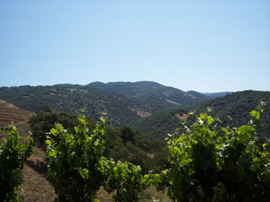
This ranch stretches over 745 acres from Morrison Creek to the ridgeline. The vineyards occupy 150 acres, leaving a large area of wildland. Morrison Creek is managed by planting willows and alders along the banks and allowing the creek to undergo its natural processes. Steelhead trout spawn and rear upstream in Morrison Creek.